The following is a sample of recent safety work Wood Rodgers has delivered. Much of this work is in line with the FHWA Systemic Process and is focused on a data-driven approach to reduce crashes across all modes.
City of Las Vegas Citywide Intersection Crash Mitigation Program and Vision Zero Plan
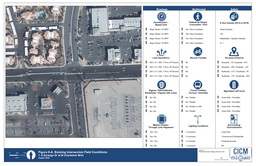 The CICMP was developed to identify intersections with the highest number of crashes and highest crash rates,
with a particular focus on vehicle-pedestrian fatal crash intersections. The program applied the FHWA Systemic
Approach to develop countermeasures within future CIP projects to prevent future fatalities and reach the goal of Vision Zero
– no fatalities or serious injuries involving road traffic. Wood Rodgers analyzed all signalized intersections within the
City of Las Vegas limits using ArcGIS. The results of the CICMP are being used to inform CIP programming towards the top 10
intersection with the highest potential for safety improvements. Based on the success of the program, the City of Las Vegas
has engaged Wood Rodgers to develop their first Vision Zero Program.
The CICMP was developed to identify intersections with the highest number of crashes and highest crash rates,
with a particular focus on vehicle-pedestrian fatal crash intersections. The program applied the FHWA Systemic
Approach to develop countermeasures within future CIP projects to prevent future fatalities and reach the goal of Vision Zero
– no fatalities or serious injuries involving road traffic. Wood Rodgers analyzed all signalized intersections within the
City of Las Vegas limits using ArcGIS. The results of the CICMP are being used to inform CIP programming towards the top 10
intersection with the highest potential for safety improvements. Based on the success of the program, the City of Las Vegas
has engaged Wood Rodgers to develop their first Vision Zero Program.
W 4th Street Safety Management Plan
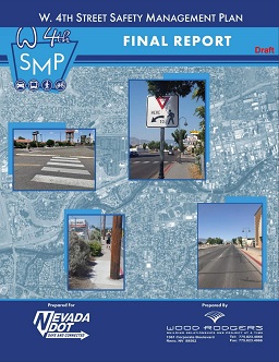 Wood Rodgers is completing a Safety Management Plan (SMP) for W 4th Street in the City of Reno,
from North Virginia Street to McCarran Boulevard. SMPs are a data-driven approach to identify systemic
safety improvements across all modes and is the precursor program to NDOT’s forthcoming Local Road Safety
Plan program. Key challenges in this SMP include a planned redevelopment district, lack
of multimodal infrastructure through much of the corridor, and high pedestrian fatalities
near downtown Reno. Countermeasures include intersection conversions to roundabouts, complete
street roadway reconfigurations, and systemic intersection improvements.
Wood Rodgers is completing a Safety Management Plan (SMP) for W 4th Street in the City of Reno,
from North Virginia Street to McCarran Boulevard. SMPs are a data-driven approach to identify systemic
safety improvements across all modes and is the precursor program to NDOT’s forthcoming Local Road Safety
Plan program. Key challenges in this SMP include a planned redevelopment district, lack
of multimodal infrastructure through much of the corridor, and high pedestrian fatalities
near downtown Reno. Countermeasures include intersection conversions to roundabouts, complete
street roadway reconfigurations, and systemic intersection improvements.
North McCarran Safety Management Plan
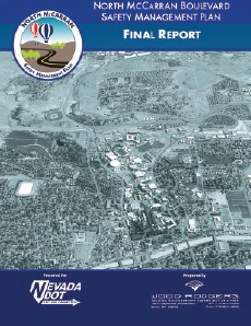 This SMP focused on McCarran Boulevard from Summit Ridge Drive to US 395.
High speeds in segments of the study area were identified as a key crash factor.
Mitigations included a series of roundabouts to slow all travel in priority segments.
Other countermeasures included multimodal infrastructure, lane reconfigurations,
and a reconfiguration of the I-80 interchange into a Diverging Diamond.
This SMP focused on McCarran Boulevard from Summit Ridge Drive to US 395.
High speeds in segments of the study area were identified as a key crash factor.
Mitigations included a series of roundabouts to slow all travel in priority segments.
Other countermeasures included multimodal infrastructure, lane reconfigurations,
and a reconfiguration of the I-80 interchange into a Diverging Diamond.
Lamb Boulevard Safety Management Plan
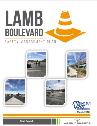 The Lamb Boulevard SMP spanned from Desert Inn Road to Lake Mead Boulevard and
crossed both City of Las Vegas and Clark County jurisdictions. Lamb Boulevard
suffers from many of the same safety issues as other large arterials in Clark
County with high speeds, lack of comfortable multimodal infrastructure, and
high crashes at intersections. Identified countermeasures included multimodal
infrastructure, reduced lane widths, and intersection safety enhancements.
The Lamb Boulevard SMP spanned from Desert Inn Road to Lake Mead Boulevard and
crossed both City of Las Vegas and Clark County jurisdictions. Lamb Boulevard
suffers from many of the same safety issues as other large arterials in Clark
County with high speeds, lack of comfortable multimodal infrastructure, and
high crashes at intersections. Identified countermeasures included multimodal
infrastructure, reduced lane widths, and intersection safety enhancements.
2nd Street/Arlington Avenue Safety Management Plan
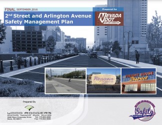 This SMP spanned 2nd Street from Keystone Avenue to Galletti Way and Arlington Avenue
from California Street to W 6th Street. Key safety challenges in these corridors
included lack of multimodal infrastructure, excessive pavement widths, and lack of safe
crossing opportunities for pedestrians, particularly at night. Countermeasures included
complete street roadway reconfigurations, pedestrian crossings, and intersection
conversions to roundabouts.
This SMP spanned 2nd Street from Keystone Avenue to Galletti Way and Arlington Avenue
from California Street to W 6th Street. Key safety challenges in these corridors
included lack of multimodal infrastructure, excessive pavement widths, and lack of safe
crossing opportunities for pedestrians, particularly at night. Countermeasures included
complete street roadway reconfigurations, pedestrian crossings, and intersection
conversions to roundabouts.
Branding Examples
| US50 Corridor Management Plan | |
| US50 Action Plan | |
| J59 Corridor Study | |
| Eastern Avenue Corridor Study | |
| South Meadows Study | |
| Wells Downtown Corridor Study | |
| SR 49 Multimodal Corridor Plan | |
| NE Valley Transportation Network Study | |
| Tahoe East Shore Sign Guidelines |